Tinh Son La Holiday Weather today
Date/time of update: December 21, 2025, 12:17 am, Timezone: GMT+7
Clear Sky
Temperature: 11.55°C
Temperature feels like: 11.35°C
Minimum Temperature: 11.55°C
Maximum Temperature: 11.55°C
Atmospheric pressure: 1020hPa
Humidity:99%
Visibility: 10000m
Wind speed: 1.12m/sec
Wind Direction: 155 degrees
Cloudiness: 6%
Sunrise: 2025-12-20 11:36:41
Sunset: 2025-12-21 10:27:14
Pha Din is a 32-km mountain pass connecting Son La and Dien Bien via Route 6. “Pha Din” in local Thai Language means “Heaven and Earth”. The highest point on the pass is over 1,600m above sea level. The pass is one of the four most sublime mountain passes in northern Vietnam. The other three are O Quy Ho (between Lai Chau and Lao Cai), Ma Pi Leng (Ha Giang), Khau Pha (Yen Bai).

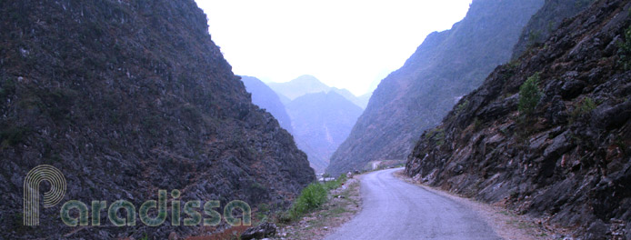
Road goes up from Son La side
Travel Guide to the Pha Din Pass between Son La and Dien Bien
Pha Din was virtually the only main single supply route that Viet Minh used for Dien Bien Phu Battle. The pass was heavily bombed by the French during the time and the summit was completely stripped off of trees which turned it into the most deadly part of the route. Besides, the road was in horrible conditions and the gradients were steep. And the Viet Minh made it all through including bringing in the 25-ton howitzers...

There are a few twists and turns going up the pass
Nowadays, traveling on Pha Din is not a difficult job given the road now is in great conditions. Once you pass the top, the newly-made road goes lower and less steep than the original one. The scenery is just wonderful anyway!


Some nice mountain scene on Pha Din

There's a lake near the summit of Pha Din

The road is quite steep on the Dien Bien side


