Tinh Ha Tinh Holiday Weather today
Date/time of update: April 20, 2025, 1:46 am, Timezone: GMT+7
Broken Clouds
Temperature: 31.55°C
Temperature feels like: 34.98°C
Minimum Temperature: 31.55°C
Maximum Temperature: 31.55°C
Atmospheric pressure: 1008hPa
Humidity:56%
Visibility: 10000m
Wind speed: 1.18m/sec
Wind Direction: 19 degrees
Cloudiness: 71%
Sunrise: 2025-04-19 10:36:44
Sunset: 2025-04-20 11:14:46
Ha Tinh is located to the north of the Central Region of Vietnam. The province is bordered to the north by Nghe An, to the east by East Vietnam Sea, to the south by Quang Binh and to the west by Laos. Ha Tinh is not visited much by neither Vietnamese domestic tourists nor foreign visitors.
Geography
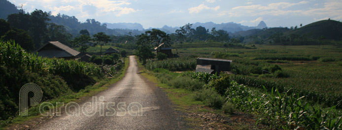
The terrain of Ha Tinh is higher to the north-west and lower to the south-east. The Truong Son Range is heavily forested to the west with average altitude 1,500m and with the highest peak of Rao Co (2,235m).
Along the 137km coastline to the east of Ha Tinh is a narrow strip of flat plains with average altitude of 5m. There are rivers and estuaries dissecting these plains.
In between the high mountains to the west and the low plains to the east is a series of low hills and small valleys in the middle of the province.
There are about 40 rivers in Ha Tinh: Lam, Ngan Sau, Ngan Pho, Ha Vang, Nghen, Rao Cai, Lac Giang… Due to steep terrains that these rivers could have devastating strong flows, especially during the rainy season.
Weather and Climate
Ha Tinh has a monsoon tropic climate. The summer is from April through October with high temperatures (above 40oC) and dry air, and with south-westerly winds.
There are often torrential rains accompanied by typhoons and floods from late July through October. Winter is from November through March which is cold (as low as 6oC) and which is often accompanied by drizzles.
The annual rainfall is from 2,500mm-2,650mm. Ha Tinh along with Nghe An has harshest weather patterns compared to other provinces in Vietnam.
People and Population
The ethnic minorities in Ha Tinh include: Kinh, Thai, Muong, Chut, Lao
Ha Tinh Travel Guide, Tourist Attractions, What to see in Ha Tinh
1/ Vu Quang National Park
2/ Ke Go Nature Reserve
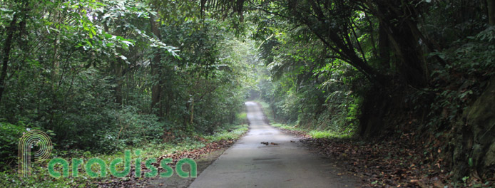
The western region of Ha Tinh is home to mountains and dense forests with rich wildlife. There are several chances for eco adventures in Vu Quang National Park and Ke Go Nature Reserve.
3/ Thien Cam Beach
There are some lowkey beaches on the coast at Ha Tinh of which the best is Thien Cam Beach. There are some big harbors on the coast at Ha Tinh that are hopeless for tourism.
Travel and Tours, Things to do in Ha Tinh
Paradissa offers adventure tours and eco tours to Ha Tinh. We could arrange wildlife spotting tours and safaris upon request. Accommodations on these tours are at hotels with basic facilities.
Ha Tinh is by far a poor province with a very poor population. The newly introduced industrial zones and harbors do not make life here better but bring along quite a lot of social problems and environmental catastrophes. Local tourism in Ha Tinh is quite hopeless without much demands. There are tourist companies and travel agencies in Ha Tinh who often have to make money via other businesses.
Where to Stay, Hotels in Ha Tinh
There are several hotels in Ha Tinh of different categories. Most hotels are for business travelers to the harbors and industrial zones in the province. There are luxury hotels and resorts in Ha Tinh City and on some beaches. Prices for travel and hospitality services in Ha Tinh are very reasonable compared to other provinces in Vietnam.
How to travel to Ha Tinh, Getting there and away
1/By road
- Ha Tinh provincial capital is 341km south of Hanoi via Route 1A which is in excellent.
- Ha Tinh has an international land border-crossing with Laos: Cau Treo (Ha Tinh, Vietnam) – Nam Phao (Kham Mouane, Laos).
2/ By train
- There are many daily trains between Hanoi and Ho Chi Minh City which stops at Ha Tinh.
Ha Tinh Average Monthly Rainfall and Temperatures


