Dien Bien Phu Holiday Weather today
Date/time of update: April 22, 2025, 12:40 am, Timezone: GMT+7
Overcast Clouds
Temperature: 23.85°C
Temperature feels like: 24.56°C
Minimum Temperature: 23.85°C
Maximum Temperature: 23.85°C
Atmospheric pressure: 1012hPa
Humidity:87%
Visibility: 10000m
Wind speed: 0.71m/sec
Wind Direction: 244 degrees
Cloudiness: 100%
Sunrise: 2025-04-21 10:43:16
Sunset: 2025-04-22 11:29:19
Muong Phang is a valley 30km from Dien Bien Phu City via route 279 (Route 41 during the Dien Bien Phu Battle), 20km via the mountain path and 10km as the crow flies.
Historical Guide to the Dien Bien Phu Battle
Overview

Muong Phang was well hidden by dense forests and ranges of mountains. The mountain peaks at Muong Phang could offer clear views of the Muong Thanh Valley where the Dien Bien Phu Battle took place. That was why the valley was chosen to house Viet Minh's Campaign Headquarters from 31-January-1954 to 15-May-1954. It was in the valley of Muong Phang that models of the French Dien Bien Phu Hedgehog were made to train the commanders of the Viet Minh troops before the battles.

Viet Minh's Muong Phang Headquarters
Before Muong Phang, the Headquarters was at Tham Pua Cave at Chieng Sinh Commune in Tuan Giao District (17-December-1953 to 17-January-1954) and Huoi He Village at Na Tau Commune (18-January-1954 to 30-January-1954).

General Giap's hut at Muong Phang
Traveling to Muong Phang nowadays you can still visit the huts housing different commanding departments of the Viet Minh's troops. The site is still covered by dense forest and hidden from aerial view. In the back of the area, there used to be trails leading the the mountain peaks where General Giap and his comrades observed and commanded the battles in the Muong Thanh Valley. We could still climb the mountains following trails used by villagers.

Hut for planning and commanding battles
Muong Phang is inhabited by the Black Thai ethnic group. Their villages can be visited on your trip here. You may also want to visit Pa Khoang Lake a body of water surrounded by dense forest 7km from the center of the valley.

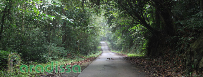
Hiking trail at Muong Phang

Trail through a forest

Pu Huot Peak
Things to do, Travel and Tours
Paradissa offers different trips which travel through Muong Phang: historical tours, battlefield tours and bicycle tours. Our mountain biking trips take you on an adventure through Thai villages, forests, scenic rice terraces to Dien Bien Phu City. Some of you may want to climb the Pu Huot and Pu To Coong Mountains where General Giap observed and commanded the battles of Dien Bien Phu. The hike takes half a day.

Aerial view of Muong Thanh Valley

Pa Khoang Lake
Where to stay and eat, Accommodations & restaurants
Accommodations and restaurants are not readily available at Muong Phang yet. Paradissa could arrange the services at a local Thai family. If you travel solo to Muong Phang, you'd better bring along your own food.
Dien Bien Average Monthly Rainfall and Temperatures


