Tinh Son La Holiday Weather today
Date/time of update: April 26, 2025, 1:30 am, Timezone: GMT+7
Broken Clouds
Temperature: 25.41°C
Temperature feels like: 25.73°C
Minimum Temperature: 25.41°C
Maximum Temperature: 25.41°C
Atmospheric pressure: 1012hPa
Humidity:66%
Visibility: 10000m
Wind speed: 2.31m/sec
Wind Direction: 130 degrees
Cloudiness: 65%
Sunrise: 2025-04-25 10:36:42
Sunset: 2025-04-26 11:26:40
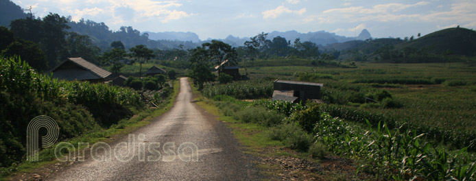
Mount Pha Luong, about 2,000m above sea level, is located in Chieng Son Commune, Moc Chau District, Son La Province. The mountain stretches right on the border between Vietnam and Laos.
 Scenic landscape on the trek to the summit of Mount Pha Luong
Travel Guide to the Pha Luong Mountain, Son La

Border Security
Because of the geographical location of Mount Pha Luong, foreign visitors are to obtain a special permit from the provincial police to climb Pha Luong.
Vietnamese tourists are permitted to climb the mountain on the condition that they possess a valid ID card/passport which are to be left at the border police before climbing and that they must show up at the border police office before noon before they begin the hike. Overnight stay in the restricted area of Mount Pha Luong is prohibited though it is alright to stay at the base of the mountain, near the border police station.

A huge boulder in the forest of Mount Pha Luong
How to get there
To get to Pha Luong from Moc Chau Town, you have to travel for 30km on a good road heading to Loong Sap border check-point. Once arriving at the Pha Luong Village (Black Hmong), you have to travel for 10km further to the base of the mountain on a horrendous path. You can only travel by motorbike or on foot on this path. When it rains it is recommended that you delay your adventure to Pha Luong, as the path is too slippery and too dangerous to travel on.

A bamboo ladder on the path to the top of Pha Luong
What the trek is like?
Once arriving at the border police station, you are to leave your papers before the adventure to the summit. Then, trek along the mountain slope amid rice terraces for half an hour. There is no cover in this part and you should have a sun hat and sunglasses with you.

A path on the summit of Pha Luong
Then, you enter the forest and follow a small trail which goes upwards all the time through dense forest. Sometimes, the path goes up vertically and you have to climb bamboo ladders to get up. There are huge rocks covered with moss along the way. You'll notice there are so many huge boulders in the area of Pha Luong Mountain that are not often seen elsewhere. Be sure you have enough drinking water and food the the hike.

Scenic view from the summit of Pha Luong
If you are a good mountain climber, you may reach the summit of Pha Luong in 3-4 hours including stops on the trek. Once you are on the top, you'll have a magnificent view of the sublime mountains all around. The winds are often extremely strong on the mountain top, do not try to get to the edge of the top area, even though you may have great angles for photography from there.

Mountains around Pha Luong
Notes before leaving
The descent takes at least one hour and a half. Remember to collect your belongings at the border police before leaving. Normally the police officers would ask you to have a tea break with them and adore the wild landscape around. These folk are very friendly and different from what you would normally encounter in cities. Remember again that the 10km from this Pha Luong community to the Pha Luong Village is not to travel on when it rains. You may be late on your schedule, but it is far better safe than sorry.

The best time to visit
The best time to climb Mount Pha Luong is in the dry season which is from December to April. It may be cool during this period and bringing along warm clothes is a must. The maple forest at Pha Luong turns into beautiful red and yellow colors around September and October, but there may be typhoons during this time and you are advised to check the weather before departure.


